We have been mainly in transit this morning back up to the northern Channel Islands so thought we would provide a quick from the field update and a little bit about the geology of the area where we are working. We are steaming west now in a heavy fog but just bumped into a small pod of transient killer whales and are observing them. There are some bottlenose and Risso’s dolphins as well as elephant seals in the area, so it might get interesting. We just had the group of eight orcas swim right past us as we were stationary, which was impressive; photos will follow at some point. We will likely be out of internet range tonight and tomorrow, so stay tuned for an update on Friday about our progress and how this current situation develops.
Throughout this project we have had the privilege of working in some remarkable and beautiful places. The eight Channel Islands cover 160 miles off southern California and include a northern cluster (San Miguel, Santa Rosa, Santa Cruz, and Anacapa) and a southern group (Santa Barbara, San Nicholas, Santa Catalina, and San Clemente) that is more dispersed. During the course of SOCAL-BRS we have worked around all eight of the islands and this year have anchored in the lee of five of them. They are fairly rugged and quite dry with desert-like plants. Like many places near people, some of them (such as Santa Barbara) have been heavily impacted by people, but for the most part they are amazingly undeveloped. They are quite distinct for being as close to one another as they are, and they are all really remarkable in their natural history and in their geology.
The foundation of rocks making up the islands seems old at over 100 million years, but even that is relatively young in a geological perspective and most of the changes that have made them into their current form are more recent. Like much of California, they have been formed and modified by the fact they are on an active margin between the oceanic Pacific plate and the continental North American. A smaller plate (the Farallon) began being pushed under the North American plate about 30 million years ago and the modern marine basin formed in which the Channel Islands began forming from the compression of sedimentary rocks and uplift of the basement foundation. These areas have been changed as well by historical rises and falls in global sea level. During the last ice age the northern channel islands were actually one large island was called Santarosae.
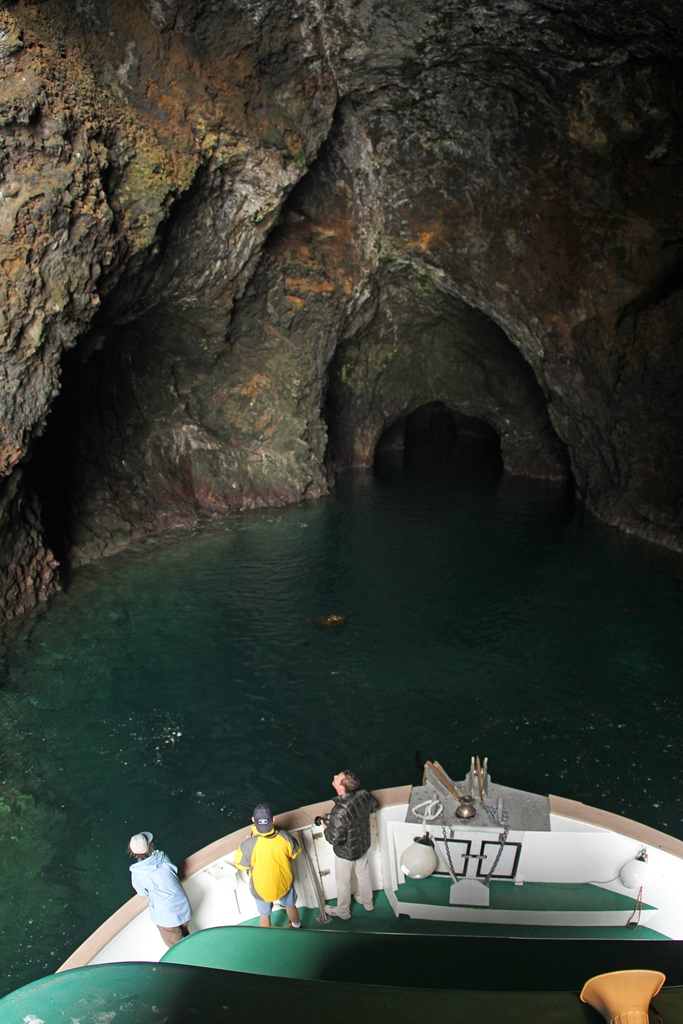
Like many areas with recent and ongoing tectonic activity, the Channel Islands have an associated diversity of visible geology. While our ability to explore the area has obviously been very limited with the round the clock pace of operations out here and covering the large areas of ocean we do, we have had a few chances to observe some of this geology. If you click the link here <SantaBarbaraIslandDragonBlowhole> you can see a short movie of a tripartite blowhole on the south side of Santa Barbara Island that we caught blowing in the surf the other day. Below is a photo taken inside the second largest sea cave in the world (almost a quarter mile of water extending into it) located on the north side of Santa Cruz Island. This photo of the cave (where scenes from the first Pirates of the Caribbean movie was shot) was taken from the main research vessel used in our project. These are just a few examples of how cool the Channel Islands are, beyond the rich marine life that has brought our studies to this special place.

